- Homepage
- Author
- Aleister Crowley (10)
- Anonymous (12)
- C H Spurgeon (10)
- Charles Dickens (25)
- Edgar Allan Poe (14)
- God (22)
- John Dee (21)
- L. Frank Baum (10)
- Lewis Carroll (41)
- Louisa May Alcott (10)
- Maria Parloa (9)
- Mark Twain (8)
- Mixed Authors (11)
- Rudyard Kipling (24)
- Selected (8)
- Unknow (8)
- Unknown (32)
- Various (41)
- Walter Scott (9)
- William Shakespeare (28)
- ... (5064)
- Binding
- Cloth (54)
- Cloth & Boards (2)
- Disbound (3)
- Fine Binding (204)
- Framed (2)
- Good (8)
- Hardback (115)
- Hardcover (1128)
- Hardcover / (4)
- Hardcover W / Jacket (3)
- Leather (504)
- Leather / Hardcover (4)
- Manuscript (26)
- Original Copy (99)
- Paperback (6)
- Pigskin (2)
- Softcover (3)
- Softcover, Wraps (87)
- Spiral (2)
- Vellum (54)
- ... (3107)
- Language
- Publisher
- Antiquity (47)
- Cassell (7)
- Collector Books (13)
- David Mckay (6)
- Doubleday (7)
- Estes And Lauriat (9)
- Frank Leslie (6)
- Funk & Wagnalls (9)
- Grosset & Dunlap (22)
- Harper & Brothers (14)
- Lille, Blocquel (7)
- Macmillan (14)
- Macmillan And Co. (13)
- Passmore & Alabaster (6)
- Roberts Brothers (6)
- Selected (6)
- The Century Company (9)
- Transylvania Amira (7)
- Unknown (12)
- Various (24)
- ... (5173)
- Subject
- Americana (63)
- Art & Photography (57)
- Children's (183)
- Classic Literature (12)
- Cooking (44)
- Exploration & Travel (51)
- History (278)
- Illustrated (31)
- Law & Government (20)
- Literature (12)
- Literature & Fiction (297)
- Military & War (17)
- Misc (12)
- Outdoor & Nature (15)
- Philosophy (15)
- Poetry (14)
- Reference (52)
- Religion, Bibles (17)
- Science & Medicine (113)
- Sports & Recreation (12)
- ... (4102)
- Topic
Robert Mills Atlas Of South Carolina Districts 1965 Giant Book Rare Maps


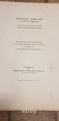
I know what it is and I know what I paid I will make a deal but please dont insult me. Also we will not be sending any photos of any districts, thanks. This is the 1965 Limited Facsimile Printing of MILLS' ATLAS OF SOUTH CAROLINA, AN ATLAS OF THE DISTRICTS OF SOUTH CAROLINA IN 1825, Compiled by Robert Mills, Engineer and Architect. This Limited Edition has been faithfully reproduced from the original engravings and includes an Introduction by Charles E.
Lee, Director South Carolina Archives Department. It was Published by Robert Pearce Wilkins & John D.
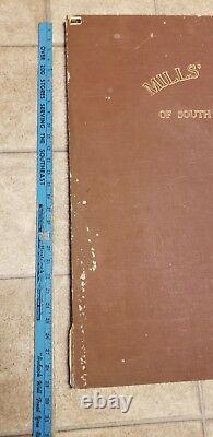
The atlas maps measure 25" x 29", but many of the 28 District Maps that comprise the atlas are folded, and when unfolded measure as much as 42" wide and 37" tall. Besides the 28 maps that comprise the districts of South Carolina, there is a title page, followed by a Preface and an introductory page, followed by a map of the state colored by district, which was executed for this atlas by another mapmaker, F. The atlas is bound in brown buckram cloth titled and decorated in gilt on the front cover. This Atlas is complete missing nothing.If you have any questions just ask!! The item "Robert Mills Atlas Of South Carolina Districts 1965 Giant Book Rare Maps" is in sale since Wednesday, April 3, 2019. This item is in the category "Antiques\Maps, Atlases & Globes\Map & Globe Reproductions". The seller is "hodgepodge2018" and is located in Greenwood, South Carolina.
This item can be shipped to United States, Canada, United Kingdom, Denmark, Romania, Slovakia, Bulgaria, Czech republic, Finland, Hungary, Latvia, Lithuania, Malta, Estonia, Australia, Greece, Portugal, Cyprus, Slovenia, Japan, China, Sweden, South Korea, Indonesia, Taiwan, South africa, Thailand, Belgium, France, Hong Kong, Ireland, Netherlands, Poland, Spain, Italy, Germany, Austria, Bahamas, Israel, Mexico, New Zealand, Singapore, Switzerland, Norway, Saudi arabia, Ukraine, United arab emirates, Qatar, Kuwait, Bahrain, Croatia, Malaysia, Brazil, Colombia, Costa rica, Panama, Trinidad and tobago, Guatemala, Honduras, Jamaica, Barbados, Bangladesh, Bermuda, Brunei darussalam, Bolivia, Ecuador, Egypt, French guiana, Guernsey, Gibraltar, Guadeloupe, Iceland, Jersey, Jordan, Cambodia, Cayman islands, Liechtenstein, Sri lanka, Luxembourg, Monaco, Macao, Martinique, Maldives, Nicaragua, Oman, Peru, Pakistan, Paraguay, Reunion, Viet nam, Uruguay.
- Year: 1965
- Format: Atlas

