
- Homepage
- Author
- Aleister Crowley (10)
- Anonymous (12)
- C H Spurgeon (10)
- Charles Dickens (25)
- Edgar Allan Poe (14)
- God (22)
- John Dee (21)
- L. Frank Baum (10)
- Lewis Carroll (41)
- Louisa May Alcott (10)
- Maria Parloa (9)
- Mark Twain (8)
- Mixed Authors (11)
- Rudyard Kipling (23)
- Selected (8)
- Unknow (8)
- Unknown (32)
- Various (39)
- Walter Scott (9)
- William Shakespeare (28)
- ... (5061)
- Era
- Format
- Language
- Narrative Type
- Topic
Rare Antique Homann World Atlas Scholasticus 31 Maps Original Colors 1750
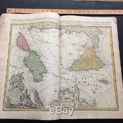
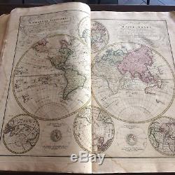
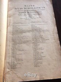
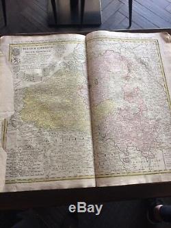
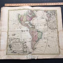
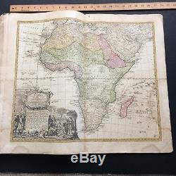
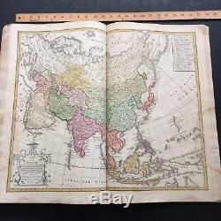
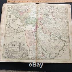
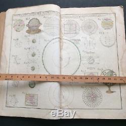
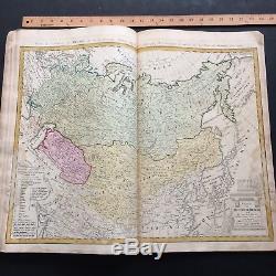
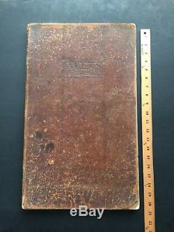
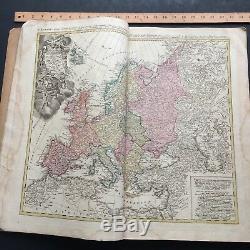


A rare original Atlas scholastic us by famous German Geographer Homann. This atlas in his original binding contains 31 double page maps all in original period colors. The binding in brown leather shows some minimal issues as these atlases were intended for students in the 18th century in Germany and are rare survivors. The atlas title page shows 36 maps, however 31 maps are present please see map list below.
Homann atlases vary between editions from 20 to 150 maps depending on orders, and years. The maps printed on thick paper are beautifully illustrated with large cartouches typical of the period. Maps are from early 1720s to mid and late 1780s as it was typically done with Homann atlases as Homann family published atlas from early 1700 to 1800 with Homann-Eirben family. The maps overall are in good condition for the period and considering its age. Some minor stain and damps visible on the side of few maps as seen on pictures.
Otherwise a classical Homann world atlas with some really beautiful maps. 16 Catholic Belgium (repaired on left margin). 18 Sicily Corsica Malta etc.. 25 Scandinavian Countries, Norway, Sweden, Finland.... 26 Russian Empire Japan Korea. 27 Turkey Middle East Arabian peninsula. 28 Asia and South East Asia.31 America North and South. The atlas is a large folio 21 x 12 inches. Maps are all double page 21 x 22. All my items are guaranteed to be original from the period described. The item "RARE ANTIQUE HOMANN WORLD ATLAS SCHOLASTICUS 31 MAPS ORIGINAL COLORS 1750" is in sale since Friday, January 18, 2019.
This item is in the category "Books\Antiquarian & Collectible". The seller is "rdraremapsandbooks" and is located in Pasadena, California. This item can be shipped to United States.- Region: Asia
- Subject: Reference
- Author: HOMANN
- Topic: Atlases
- Language: Latin
- Special Attributes: Illustrated
- Original/Facsimile: Original
- Binding: Leather

