
- Homepage
- Author
- Aleister Crowley (10)
- Anonymous (12)
- C H Spurgeon (10)
- Charles Dickens (25)
- Edgar Allan Poe (14)
- God (22)
- John Dee (21)
- John Milton (8)
- L. Frank Baum (10)
- Lewis Carroll (41)
- Louisa May Alcott (10)
- Maria Parloa (9)
- Mark Twain (8)
- Mixed Authors (11)
- Rudyard Kipling (23)
- Selected (8)
- Unknown (32)
- Various (39)
- Walter Scott (9)
- William Shakespeare (28)
- ... (5057)
- Binding
- Cloth (54)
- Cloth & Boards (2)
- Disbound (3)
- Fine Binding (203)
- Framed (2)
- Good (8)
- Hardback (115)
- Hardcover (1122)
- Hardcover / (4)
- Hardcover W / Jacket (3)
- Leather (504)
- Leather / Hardcover (4)
- Manuscript (26)
- Original Copy (99)
- Paperback (6)
- Pigskin (2)
- Softcover (3)
- Softcover, Wraps (87)
- Spiral (2)
- Vellum (54)
- ... (3104)
- Language
- Region
- Subject
- Americana (63)
- Art & Photography (57)
- Children's (182)
- Classic Literature (12)
- Cooking (44)
- Exploration & Travel (51)
- History (277)
- Illustrated (31)
- Law & Government (20)
- Literature (12)
- Literature & Fiction (295)
- Military & War (17)
- Outdoor & Nature (15)
- Performing Arts (10)
- Philosophy (15)
- Poetry (14)
- Reference (51)
- Religion, Bibles (17)
- Science & Medicine (113)
- Sports & Recreation (12)
- ... (4099)
- Topic
1856 First Edition Colton World Atlas Folio Hand Colored Map Antique 1st Ed Rare
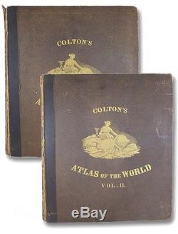
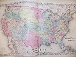
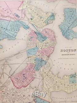

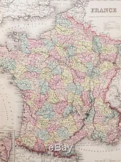


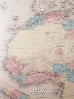


Colton's Atlas of the World, illustrating Physical and Political Geography. Accompanied by Descriptions Geographical, Statistical, and Historical, in Two Volumes: North and South America, Etc. Europe, Asia, Africa, Oceanica, Etc. Complete in two folio hardcover volumes. Black leather spines over brown cloth boards, gilt titles with gold illustration on front board of each volume. Each volume included engraved vignette title page preceding printed title.
First volume includes 62 plates, 61 of which are hand-colored (final map of Patagonia is not). , including a two-panel image depicting the mountains and rivers of the world. Sabin 14787 (in reference to first volume only):'Contains plans of the principal cities of the United States and Canada.
This collection of maps was also published as'Colton's Atlas of America,' for separate sale to those having European atlases of the rest of the world. Not to be confused with the single-volume folio atlas Colton released in 1888, nor the single-volume quarto version (with only 50 maps) published in 1865. Keywords: WORLD HISTORY MAPS CARTOGRAPHY ATLAS GEORGE W.
COLTON NORTH AMERICAN SOUTH AMERICA AMERICANA UNITED STATES U. GEOGRAPHY POLITICAL PHYSICAL GEOGRAPHICAL CARTOGRAPHIC CARTOGRAPHER ASIA AFRICA EUROPE. The item "1856 First Edition Colton World Atlas Folio Hand Colored Map Antique 1st Ed Rare" is in sale since Friday, June 10, 2016. This item is in the category "Books\Antiquarian & Collectible". The seller is "yesterdaysmuse" and is located in Webster, New York.This item can be shipped to United States.

