
- Homepage
- Author
- Aleister Crowley (10)
- Anonymous (12)
- C H Spurgeon (10)
- Charles Dickens (25)
- Edgar Allan Poe (14)
- God (22)
- John Dee (21)
- L. Frank Baum (10)
- Lewis Carroll (41)
- Louisa May Alcott (10)
- Maria Parloa (9)
- Mark Twain (8)
- Mixed Authors (11)
- Multiple (8)
- Rudyard Kipling (22)
- Selected (8)
- Unknown (32)
- Various (35)
- Walter Scott (8)
- William Shakespeare (28)
- ... (4994)
- Binding
- Cloth (51)
- Disbound (3)
- Fine Binding (203)
- Framed (2)
- Good (8)
- Hardback (114)
- Hardcover (1096)
- Hardcover / (4)
- Hardcover W / Jacket (3)
- Leather (495)
- Leather / Hardcover (4)
- Manuscript (26)
- Manuscript, Unbound (2)
- Original Copy (99)
- Paperback (6)
- Pigskin (2)
- Softcover (3)
- Softcover, Wraps (86)
- Spiral (2)
- Vellum (54)
- ... (3075)
- Language
- Publisher
- Antiquity (47)
- Cassell (7)
- Collector Books (12)
- David Mckay (6)
- Doubleday (6)
- Estes And Lauriat (9)
- Frank Leslie (6)
- Funk & Wagnalls (9)
- Grosset & Dunlap (22)
- Harper & Brothers (13)
- Lille, Blocquel (7)
- Macmillan (14)
- Macmillan And Co. (12)
- Passmore & Alabaster (6)
- Porter & Coates (5)
- Selected (6)
- The Century Company (9)
- Transylvania Amira (7)
- Unknown (12)
- Various (17)
- ... (5106)
- Subject
- Americana (63)
- Art & Photography (57)
- Children's (177)
- Classic Literature (12)
- Cooking (44)
- Exploration & Travel (51)
- History (273)
- Illustrated (31)
- Law & Government (19)
- Literature (10)
- Literature & Fiction (288)
- Military & War (17)
- Outdoor & Nature (13)
- Performing Arts (10)
- Philosophy (15)
- Poetry (11)
- Reference (49)
- Religion, Bibles (17)
- Science & Medicine (111)
- Sports & Recreation (12)
- ... (4058)
- Year Printed
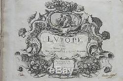
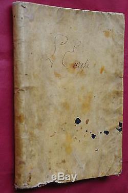
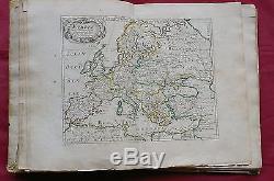
1647 RARE 1st Edition ATLAS EUROPE by Nicolas Sanson (the son) 12 maps Colored
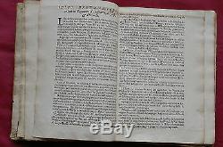
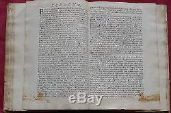
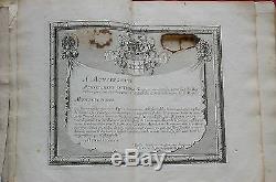
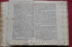
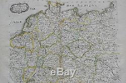
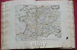


Very rare first edition of the only atlas by. The present copy is in.
First edition with inscription on title page. Paris, chez LAutheur avec Privilege pour 20 ans.
All the maps bearing Chez Lautheur avec privilege. This edition is not dated but it is probably the one that appeared shortly before his death. There was one other edition with 13 maps also mentioning Chez Lautheur avec Privilege pour 20 ans which according to Mireille Pastoureau in Les Atlas français XVIe-XVIIe siècles, was published in 1648. The atlas was later published with the inscription Chez L'Autheur (but without the mention Privilege pour 20 ans) and by Pierre Mariette in 1660 and 1665 (at least 13 years after this edition).
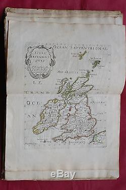
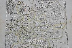
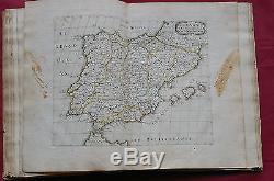
In 1697 it appeared in expanded form with Pierre Moullart-Sanson. The maps were also printed under the name of his father, Nicolas Sanson d'Abbéville, as a part of an atlas of the four known continents of the world. LEUROPE, Dediée a Monseigneur le Tellier Secret dEstat Par N. Sanson le fils Geographe du Roy. One volume (24,5 x 19 cm or about 9 2/3 x 7 ½); engraved allegorical title, engraved dedication, [30] text folios, 12 maps.Complete with 12 double-page copper engraved maps with original outline color. 2- Isles Britanniques , British Isles Man Island, Ireland, Scotland, England, Shetland Isles.
3- Scandinavie , Scandinavia (showing Norway, Sweden, Denmark, Finland, Shetland Isles, Estonia, Latvia, Lithuania, Baltic Sea and its islands, parts of Scotland). 4- Russie Blanche ou Moscovie , Russia. 6- Allemagne , Germany, Austria, Netherlands, Belgium, Poland, Czech Republic, Switzerland. 7- Estats de la Couronne Pologne , Poland, Moldavia. 8- Espagne , Portugal and Spain.
9- Italie , Italy, Corfu, Corsica, Sardinia, Sicily. 10- Turquie , Turkey, Greece, Crete, Aegean Sea Islands. 11- Hongrie , Romania, Bulgaria, Ukraine. 12- Mer Noire , Black Sea, Turkey, Ukraine, Bulgaria, Russia, Romania. Burn hole on dedication plate, manuscript entry on title, maps and text soiled and stained, leaves reinforced.
Binding defective and very soiled. Pastoureau, Mireille : Les Atlas français XVIe-XVIIe siècles. Répertoire bibliographique et étude, Bibliothèque nationale, Paris 1984, pp. Biographie Universelle (Michaud) Ancienne et Moderne, T. Hoefer (Dir): Nouvelle Biographie Générale depuis les temps les plus reculés jusqu'à nos jours, avec les renseignement bibliographiques et l'indication des sources àconsulter, Paris, 1864, T. The item "1647 RARE 1st Edition ATLAS EUROPE by Nicolas Sanson (the son) 12 maps Colored" is in sale since Wednesday, July 23, 2014. This item is in the category "Antiques\Maps, Atlases & Globes\Europe Maps". The seller is "planet-auctions" and is located in Portugal. This item can be shipped worldwide.
